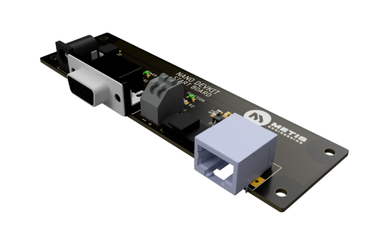
Global Navigation Satellite Systems transformed position and velocity measurement, enabling unprecedented accuracy without requiring infrastructure installation or line-of-sight constraints. However, standard GPS receivers update position data only once per second, creating substantial gaps in coverage during high-speed movement or rapid manoeuvres. Applications requiring detailed trajectory reconstruction, precise velocity measurement or sub-second event timing demand dramatically higher update rates. The 50Hz GPS CAN Sensor from Metis Engineering delivers position, velocity and timing data 50 times per second, providing the temporal resolution essential for demanding applications spanning motorsport, autonomous vehicle testing, industrial automation and research.
The Temporal Resolution Challenge
Position data updated at 1Hz provides a snapshot of location once per second. During that second interval, a vehicle travelling at 100 kilometres per hour covers nearly 28 metres. A race car at 300 km/h travels over 83 metres between updates. This enormous gap prevents detailed analysis of vehicle behaviour during that interval.
Dynamic events including braking, cornering and collision avoidance occur on timescales measured in tenths of seconds. Understanding vehicle behaviour during these critical events requires position data with temporal resolution matching the timescale of motion. Data updated every 20 milliseconds at 50Hz captures vehicle dynamics with sufficient detail for meaningful analysis.
The difference between 1Hz and 50Hz resembles comparing a photograph to video. The photograph shows where the vehicle was, whilst video reveals how it moved between positions. For applications where trajectory matters as much as location, high-update-rate positioning is essential.
Motorsport Telemetry and Performance Analysis
Professional motorsport teams deploy sophisticated telemetry systems capturing hundreds of parameters including throttle position, brake pressure, steering angle, suspension displacement and powertrain data. Position and velocity data provides the spatial and temporal reference correlating all other measurements with track location.
The 50Hz update rate matches or exceeds update rates of other vehicle sensors, ensuring position data maintains temporal alignment with system-level data collection. Engineers can correlate throttle application with position on track analysing driving technique at specific corners. Brake pressure data combined with precise position enables reconstruction of braking zones revealing potential time gains.
Lap time analysis benefits from precise sector and corner timing resolution. Whilst conventional GPS provides adequate lap time measurement, detailed sector analysis requires higher resolution. The 50Hz data enables corner-by-corner comparison between laps, drivers and vehicle setups revealing subtle performance differences.
Aerodynamic development uses position data combined with speed to identify sections where vehicles achieve expected performance versus areas showing deficit. The high update rate captures transient events including gear changes, weight transfer and aerodynamic disturbances affecting vehicle behaviour over short track distances.
Vehicle Dynamics Development and Testing
Automotive manufacturers conduct extensive vehicle dynamics development optimising handling, stability and driver experience. Test procedures including step steer inputs, lane changes and obstacle avoidance create rapid vehicle movement where trajectory matters as much as absolute position.
Traditional test equipment including GPS-assisted inertial measurement systems or optical tracking provides detailed motion data but at significant cost and complexity. The 50Hz GPS sensor delivers position and velocity sufficient for many development tasks at substantially lower price points, enabling wider deployment across test fleets.
Path-following accuracy assessment compares intended trajectory with actual vehicle path during automated manoeuvres. The continuous position data reveals how closely vehicles track desired paths, identifying deficiencies in control algorithms or vehicle responsiveness.
Electronic stability control validation requires understanding vehicle behaviour during destabilising events. High-update-rate position data combined with vehicle sensor information enables detailed reconstruction of critical seconds when stability systems intervene preventing loss of control.
Autonomous Vehicle Testing and Validation
Self-driving vehicles must demonstrate safe operation across diverse scenarios before public deployment. Validation testing compares autonomous system behaviour against ground truth data establishing whether vehicles navigate safely and according to traffic laws.
The validation system’s position accuracy must exceed the autonomous vehicle’s own localisation solution. If ground truth measurement suffers the same limitations as the system being validated, meaningful assessment becomes impossible. High-update-rate GPS provides independent position reference for validation testing.
Urban testing environments present challenging GNSS conditions with periodic signal degradation. However, during periods of good signal quality, the 50Hz sensor provides the high-resolution position data essential for analysing system behaviour during critical manoeuvres including intersection navigation, lane changes and pedestrian avoidance.
The sensor’s 50Hz capability during open-sky conditions complements the UDR variant’s dead reckoning functionality, enabling test programmes to deploy appropriate sensors matching test environment characteristics. Proving ground testing may prioritise maximum update rate whilst urban testing demands continuous coverage despite signal interruptions.
Agricultural Automation and Precision Farming
Modern agricultural equipment employs GPS guidance enabling precise navigation across fields whilst automated systems handle planting, spraying and harvesting. Sub-decimetre accuracy prevents gaps and overlaps reducing input costs and environmental impact.
High-update-rate positioning supports implement control and quality documentation. Spray systems must activate and deactivate precisely as equipment traverses field boundaries. The temporal resolution enables precise spray activation matching implement position on the ground.
Variable-rate application adjusts seeding density, fertiliser application or irrigation based on position-specific requirements determined from yield mapping and soil analysis. High-update-rate positioning ensures application rates match intended locations rather than lagging or leading actual position.
Quality documentation for regulatory compliance and traceability systems benefits from detailed position logs demonstrating proper application patterns. The data documents that operators followed procedures and that automated systems performed correctly.
Construction and Heavy Equipment Applications
Construction equipment automation improves efficiency whilst addressing operator shortages. Automated grading systems use GPS positioning achieving accuracy unattainable through manual operation, reducing material costs and project timelines.
High-update-rate positioning enables precise control during movement ensuring blade angles and positions follow design specifications continuously. Lower update rates would create position uncertainty during the time between measurements potentially causing over-cutting or under-cutting.
Material hauling automation in quarries and mining operations relies on precise vehicle positioning for navigation between loading and dumping locations. Fleet management systems track equipment location and productivity supporting operational optimisation.
Safety systems warning operators of nearby personnel or obstacles require current position data with minimal latency. High update rates reduce the time between actual position changes and data availability enabling faster safety system response.
Surveying and Mapping Applications
Mobile mapping systems mounted on vehicles capture imagery and sensor data whilst driving, requiring precise position and attitude data associating measurements with geographic location. The rapid data capture rate during vehicle movement demands high-frequency positioning maintaining temporal alignment with other sensors.
Lidar mapping, panoramic photography and sensor surveys all benefit from 50Hz position data. Each measurement must be geo-referenced accurately requiring position data matching the temporal frequency of data collection. Lower GPS update rates would require interpolation introducing uncertainty.
Infrastructure inspection and asset management surveys document highway conditions, utility networks and public infrastructure. The position data supports maintenance planning and regulatory reporting whilst the continuous coverage ensures complete documentation without gaps.
UAV and Drone Navigation
Unmanned aerial vehicles employ GPS positioning for navigation and station-keeping. The dynamic flight characteristics and rapid position changes during manoeuvres benefit from high-update-rate positioning improving flight control and mission execution.
Photogrammetry and aerial surveying drones capture rapid sequences of overlapping images whilst flying predetermined paths. Accurate position data for each image enables photogrammetry processing creating orthomosaics and 3D models. The high update rate improves geo-referencing accuracy particularly during variable wind conditions affecting flight path.
Beyond-visual-line-of-sight operations and automated flight planning rely on accurate position feedback ensuring drones follow programmed routes and respond appropriately to commands. The low latency inherent in 50Hz updates improves control loop performance.
Marine Applications and Vessel Tracking
High-speed vessels including racing boats, recreational craft and patrol vessels benefit from detailed position tracking. Performance analysis, route optimisation and safety monitoring all utilise position data characterising vessel behaviour.
Autonomous surface vessels under development for cargo transport, environmental monitoring and security applications require accurate positioning for navigation and station-keeping. The 50Hz update rate supports control algorithms maintaining position despite sea conditions and currents.
Fishing fleet management and catch documentation increasingly relies on position data demonstrating compliance with fishing regulations and catch quotas. Detailed position logs document vessel activity supporting regulatory compliance and sustainability certification.
Integration with CAN-Based Systems
The automotive CAN communication protocol provides robust, real-time data transmission suitable for vehicle networks and industrial control systems. The 50Hz GPS sensor transmits position, velocity and time data via configurable CAN interface enabling integration into existing networks.
Data acquisition systems, vehicle control computers and telemetry packages all communicate using CAN protocols making the sensor compatible with existing infrastructure. The integration simplicity enables rapid deployment without requiring specialised GPS receivers or serial-to-CAN conversion hardware.
Distributed data collection architectures benefit from CAN’s multi-master design allowing any network device to access GPS data without requiring point-to-point connections. This broadcast approach simplifies system architecture whilst enabling multiple consumers of position data.
Power Requirements and Installation
Continuous 50Hz positioning requires more electrical power than conventional low-update-rate GPS receivers. However, modern GNSS chipsets and efficient power management maintain power consumption at manageable levels suitable for automotive and portable applications.
The sensor operates across wide input voltage ranges accommodating 12V and 24V vehicle electrical systems. Compact form factor and minimal weight enable flexible installation locations without affecting vehicle dynamics or requiring structural modifications.
Automotive-grade connectors provide reliable power and CAN connections whilst the ruggedised construction withstands vibration, temperature extremes and environmental exposure typical of vehicle applications. These characteristics ensure reliable operation across demanding conditions.
Accuracy Considerations and Limitations
Position accuracy depends on multiple factors including satellite geometry, atmospheric conditions, multipath effects and receiver quality. The 50Hz sensor achieves typical accuracy of 1-2 metres under good conditions, sufficient for many applications but not suitable for surveying-grade requirements.
Applications requiring decimetre or centimetre accuracy need differential GPS or RTK corrections beyond the sensor’s standalone capability. However, for trajectory reconstruction, velocity measurement and timing applications, the standalone accuracy proves adequate whilst the high update rate provides essential temporal resolution.
The sensor operates across all GNSS constellations including GPS, GLONASS, Galileo and BeiDou, improving satellite availability and position accuracy through multi-constellation operation. This capability proves valuable in challenging environments with limited sky visibility.
Complementary Inertial Measurement
Position data alone provides limited insight without corresponding orientation and motion data. Complementary inertial sensors measuring acceleration, rotation rates and heading complete the picture of vehicle motion enabling sophisticated analysis.
Metis Engineering offers inertial measurement sensors sharing compatible CAN interfaces and similar form factors. Combined deployment of GPS and inertial sensors provides comprehensive motion tracking supporting advanced applications requiring both position and attitude data.
The sensors operate independently without requiring synchronisation hardware, simplifying installation whilst the common CAN communication enables temporal alignment through software during post-processing or real-time analysis.
The Future of High-Resolution Positioning
As autonomous systems proliferate and automation extends across industries, demand for high-quality position data continues growing. Applications requiring trajectory reconstruction, precise timing and sub-second resolution increasingly recognise that conventional GPS update rates prove inadequate.
The 50Hz GPS CAN Sensor provides proven high-update-rate positioning technology in a package designed for automotive and industrial deployment. From professional motorsport through agricultural automation and autonomous vehicle testing, high-temporal-resolution positioning enables applications that conventional sensors cannot support.
For detailed specifications, technical documentation or to discuss positioning requirements, contact Metis Engineering directly. Investment in high-update-rate GPS technology provides the temporal resolution that demanding applications require.