Global Navigation Satellite Systems revolutionised vehicle positioning, enabling precise location determination anywhere on Earth with clear sky visibility. However, GNSS-dependent systems fail exactly when positioning data becomes most critical: in urban canyons, tunnels, underpasses, multi-storey car parks and indoor test facilities. Autonomous vehicle development, advanced driver assistance system validation and vehicle dynamics testing all demand continuous position data regardless of satellite visibility. Dead reckoning technology addresses this fundamental limitation by maintaining position estimates during GNSS outages, ensuring uninterrupted data for critical applications.
Understanding Dead Reckoning Fundamentals
Dead reckoning represents one of humanity’s oldest navigation techniques, calculating current position based on previously known location, direction of travel, speed and elapsed time. Maritime navigators used dead reckoning for centuries before electronic positioning systems emerged, manually tracking vessel movement between celestial navigation fixes.
Modern automotive dead reckoning employs the same fundamental principles enhanced by sophisticated sensors and computational algorithms. Inertial measurement units containing accelerometers and gyroscopes measure vehicle motion in three dimensions, enabling calculation of position changes from a known starting point. When combined with GNSS positioning during satellite visibility, these systems provide seamless position tracking regardless of signal availability.
The critical distinction between tethered and untethered dead reckoning approaches lies in sensor integration requirements. Tethered systems require external inputs from wheel speed sensors, steering angle measurement or vehicle CAN data, creating integration complexity and limiting applicability across diverse vehicle types. Untethered systems operate entirely independently using only internal inertial sensors, eliminating integration barriers whilst providing universal compatibility.
The Urban Canyon Challenge
Modern cities create the most challenging GNSS environments anywhere on Earth. Tall buildings create street canyons where satellite visibility is limited to a narrow slice of sky directly overhead. Multipath propagation occurs as GNSS signals reflect off building facades, creating false ranging measurements that degrade position accuracy even when satellites remain theoretically visible.
Autonomous vehicle testing must occur in these challenging environments as urban operation represents the primary deployment scenario for self-driving technology. However, validating autonomous system performance requires accurate ground truth position data exactly when GNSS reliability is lowest. This paradox has historically forced compromises including limiting testing to suburban areas, deploying expensive reference systems or accepting gaps in position data.
Dead reckoning eliminates these compromises by maintaining position accuracy throughout GNSS dropouts. As vehicles navigate between buildings, enter underground car parks or drive through covered areas, inertial positioning seamlessly continues providing position estimates until satellite visibility returns. Upon GNSS signal restoration, the system automatically recalibrates, maintaining long-term accuracy without manual intervention.
Tunnel Testing Applications
Proving grounds, public roads and urban infrastructure all include tunnel sections where GNSS signals are completely blocked. Electric vehicle testing increasingly occurs in climatic chambers providing controlled thermal environments, creating another completely GNSS-denied testing environment. Battery test facilities, indoor dynamics platforms and wind tunnels all require position and velocity measurement without satellite access.
Traditional solutions including laser tracking systems, local positioning beacons or accepting data gaps each introduce limitations. Laser tracking requires expensive infrastructure and line-of-sight to the vehicle. Local beacons demand installation and calibration at each test facility. Data gaps compromise analysis quality and necessitate multiple test runs to capture complete datasets.
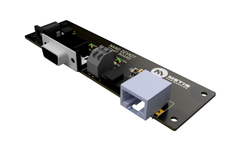
The RD UDR GPS CAN Sensor from Metis Engineering provides continuous positioning throughout GNSS-denied environments using untethered dead reckoning technology. The sensor operates identically in tunnels, indoor facilities and open-sky conditions, eliminating the need for facility-specific infrastructure or supplementary positioning systems.
Autonomous Vehicle Validation Requirements
Autonomous driving systems must demonstrate safe operation across all environments including those where GNSS reliability is compromised. Validation requires comparing intended vehicle trajectory with actual position at high temporal resolution, identifying any discrepancies that could indicate localisation failures or control system issues.
Ground truth position data must maintain accuracy independent of the autonomous system’s own localisation solution. If validation relies on the same GNSS signals that the autonomous system uses, failures affecting vehicle operation will similarly compromise validation data. This circularity prevents meaningful safety assessment during GNSS outages.
Dead reckoning provides independent ground truth positioning that continues operating when autonomous vehicle localisation encounters difficulties. This independence enables validation of how gracefully systems handle GNSS degradation, whether backup localisation modes activate appropriately and if safe operation continues during challenging conditions.
The 20Hz update rate of the UDR GPS CAN Sensor provides sufficient temporal resolution for autonomous vehicle validation whilst maintaining manageable data volumes. Position updates every 50 milliseconds capture vehicle dynamics during normal manoeuvres whilst enabling detailed analysis of system behaviour during critical events.
Rally and Motorsport Telemetry
Rally sport presents extreme positioning challenges as vehicles operate at high speeds through forests, between cliff faces, in deeply incised valleys and other environments where satellite visibility fluctuates constantly. Traditional GNSS-only systems experience frequent signal loss, creating gaps in telemetry data exactly when vehicles operate at performance limits and data is most valuable.
Dead reckoning technology enables continuous position tracking throughout rally stages regardless of satellite visibility. Teams gain complete vehicle trajectory data supporting performance analysis, driver coaching and vehicle setup optimisation. The technology also provides safety benefits, enabling precise location determination should incident response or vehicle recovery become necessary.
Circuit racing presents different challenges including pit buildings, grandstands and trackside structures that periodically block GNSS signals. Whilst total signal loss may be brief, the interruptions occur at specific circuit locations lap after lap, preventing detailed analysis of vehicle behaviour at those points. Dead reckoning eliminates these blind spots, providing complete position data around entire circuit layouts.
The ruggedised construction of the UDR GPS CAN Sensor withstands the extreme vibration, g-forces and environmental conditions typical of motorsport applications. Compact size and minimal weight ensure installations do not affect vehicle dynamics or require chassis modifications.
Advanced Vehicle Dynamics Analysis
Vehicle dynamics engineers conducting handling development, stability control validation and ride comfort assessment require precise position and velocity data during dynamic manoeuvres. Test procedures including lane changes, step steer inputs and obstacle avoidance involve rapid vehicle movement where position accuracy is critical.
Combining high-update-rate position data with vehicle sensor information including steering angle, yaw rate and lateral acceleration enables sophisticated analysis techniques. Engineers can validate electronic stability control activation thresholds, assess path-following accuracy and correlate driver inputs with vehicle response.
Side slip angle determination provides valuable insights into vehicle dynamics but requires position data of sufficient quality to differentiate between vehicle heading and direction of travel. The continuous positioning enabled by dead reckoning technology eliminates GNSS dropout complications that have historically limited side slip analysis to specific test locations or artificial conditions.
Metis Engineering provides detailed case studies demonstrating rally car side slip measurement using the UDR sensor, showcasing the analytical possibilities enabled by continuous positioning during aggressive driving on loose surfaces where GNSS reliability is particularly challenged.
Integration Simplicity and Universal Compatibility
The untethered approach eliminates integration complexity that has historically limited dead reckoning adoption. Previous-generation systems requiring wheel speed inputs, steering angle measurement or vehicle CAN connectivity introduced application-specific engineering, calibration requirements and potential compatibility issues across different vehicle platforms.
The UDR GPS CAN Sensor operates identically across passenger cars, commercial vehicles, motorcycles, off-highway equipment and any other application requiring position and velocity measurement. This universality eliminates the need for vehicle-specific variants, reduces inventory complexity for testing facilities and enables rapid deployment across diverse test fleets.
Installation requires only power connection and CAN bus interface, with the sensor beginning position transmission immediately upon startup. No initialisation procedures, calibration routines or reference position inputs are necessary, dramatically reducing deployment time compared to tethered systems.
CAN Bus Communication for Test System Integration
Modern vehicle testing employs data acquisition systems aggregating information from dozens or hundreds of sensors distributed throughout the vehicle. CAN communication represents the dominant protocol for automotive sensor networks, providing robust, noise-immune data transmission suitable for harsh testing environments.
The UDR GPS CAN Sensor transmits complete position, velocity and time data via configurable CAN interface compatible with any CAN-based data acquisition system. Engineers receive latitude, longitude, altitude, course over ground and speed in standard CAN message formats, eliminating the need for specialised GPS receivers or serial-to-CAN conversion hardware.
The configurable approach enables sensor installation on existing vehicle CAN networks without addressing conflicts or message collisions. System integrators can adjust CAN bitrate and message identifiers to match specific test system requirements, ensuring compatibility across diverse platforms and data acquisition architectures.
Comparative Performance: Standard vs Dead Reckoning GPS
The RD 50Hz GPS CAN Sensor provides high-update-rate positioning when GNSS signals remain available, offering 50Hz capability for applications requiring maximum temporal resolution. This sensor serves applications operating primarily in open-sky conditions where GNSS reliability remains high but update rate demands exceed conventional GPS capabilities.
The UDR variant sacrifices maximum update rate, operating at 20Hz, in exchange for dead reckoning functionality maintaining positioning during signal loss. This trade-off suits applications where continuous coverage is more valuable than maximum update rate, including urban testing, tunnel operations and any environment with intermittent GNSS availability.
Selecting between these options requires understanding application priorities. Circuit testing in open environments may prioritise maximum update rate. Urban autonomous vehicle validation demands continuous coverage regardless of satellite visibility. Many organisations deploy both variants, using 50Hz sensors for proving ground testing and UDR sensors for public road validation in challenging environments.
Technical Performance During GNSS Outages
Dead reckoning accuracy inherently degrades during extended GNSS outages as small inertial measurement errors accumulate over time. However, typical automotive GNSS interruptions last seconds to minutes rather than hours, limiting error accumulation to levels acceptable for most applications.
Performance during signal loss depends on vehicle dynamics, outage duration and movement complexity. Straight-line motion at constant speed represents the easiest scenario with minimal error accumulation. Aggressive cornering, acceleration and deceleration create more challenging conditions where inertial measurement errors have greater impact.
Upon GNSS signal restoration, the system automatically corrects accumulated errors through Kalman filtering techniques that optimally blend inertial and satellite positioning data. This automatic recalibration maintains long-term accuracy without requiring manual intervention or post-processing correction.
Power Management and Operational Efficiency
Continuous inertial processing requires electrical power, creating potential concerns for battery-powered applications or systems where minimising power consumption is important. However, modern microelectromechanical systems (MEMS) inertial sensors consume only milliwatts, making the power impact negligible compared to other vehicle systems.
The UDR GPS CAN Sensor operates across wide input voltage ranges accommodating different vehicle electrical architectures from 12V passenger cars through 24V commercial vehicles to high-voltage electric vehicle auxiliary systems. This flexibility eliminates the need for external power conversion or vehicle-specific variants.
Documentation and Integration Support
Comprehensive technical documentation including specification sheets, user manuals, CAN DBC files and integration guides supports rapid deployment across diverse applications. Metis Engineering provides technical assistance throughout the integration process, ensuring successful installation and optimal performance.
The standardised approach using CAN communication and automotive-grade connectors enables experienced vehicle test engineers to complete installations without requiring specialised training or support. However, application-specific guidance remains available for complex installations or unique requirements.
The Future of Vehicle Positioning
As autonomous vehicles proliferate and advanced driver assistance systems become standard equipment, the demand for robust positioning technology operating reliably across all environments will intensify. GNSS-only solutions cannot meet these requirements, making dead reckoning capability essential for safety-critical automotive applications.
The UDR GPS CAN Sensor delivers proven untethered dead reckoning technology in a package designed specifically for automotive research and development. From autonomous vehicle validation through motorsport telemetry and vehicle dynamics testing, continuous positioning regardless of satellite visibility enables applications that GNSS-only systems cannot support.
For detailed specifications, technical documentation or to discuss positioning requirements, contact Metis Engineering directly. Investment in dead reckoning technology eliminates the limitations of GNSS-only positioning systems.